

Norman, OK – Western Oklahoma is entering the early stages of a major winter storm as Arctic air pours into the state Friday morning. Temperatures are falling rapidly, wind chills are plunging below zero, and dangerous travel conditions are expected to develop by late Friday and continue through the weekend and into next week.
At 7 AM Friday, cold Arctic air was already spreading south across Oklahoma. While the core of the coldest air remains north, it is pushing steadily southward, setting the stage for a prolonged and high-impact winter storm. Wind chills across western Oklahoma will drop into the single digits today, with periods below zero expected tonight and through the weekend.
Beckham County Sheriff Derek Manning said the combination of ice, heavy snow, and bitter cold will create extremely dangerous conditions.
“I strongly urge everyone to get their necessary business done before Friday afternoon, and then stay at home if at all possible throughout the weekend,” Manning said. “If this storm occurs as forecasted, it will be dangerous and could be deadly.”
Friday Conditions
Early Friday morning travel remains mostly good across western Oklahoma, but conditions are expected to deteriorate as the day goes on.
From late morning through early afternoon, temperatures will continue falling and light freezing drizzle or black ice may begin developing, especially on bridges and overpasses. The risk increases significantly after 3 to 5 PM, particularly in southwest Oklahoma, including areas near Apache, Lawton, and surrounding communities.
By Friday evening, the first wave of the storm arrives. A mix of freezing drizzle, sleet, and snow is expected to spread from southwest to northeast. Roads are likely to glaze over quickly, creating slick and hazardous driving conditions.
Manning said crashes are only part of the danger.
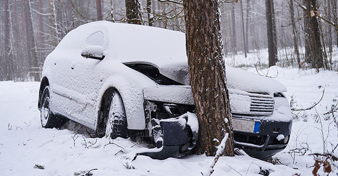
“The extremely low temperatures we’re expecting can make even a minor crash a life or death situation for someone who is in a disabled vehicle, even if they’re not injured,” he said. “Just being stuck in a ditch on a county road or highway in a vehicle that won’t start can get really dangerous if someone doesn’t get to you pretty quickly.”
Saturday and Sunday
The first wave of precipitation tapers off around midday Saturday, but travel conditions will remain dangerous. Snow-covered roads are expected north of Interstate 40, while areas south may have snow on top of ice or sleet.
Saturday afternoon and evening brings the second and more significant wave of the storm. Heavy snow develops and continues through Saturday night and into Sunday morning, possibly lingering into Sunday afternoon.
By the time the storm ends, snowfall totals across western Oklahoma are expected to range from 6 to 12 inches, with locally higher amounts possible. Areas from Lawton north toward western Canadian and Custer counties could see 4 to 8 inches. Sleet accumulation of one to three inches is possible in southern and southwestern Oklahoma, which may reduce snow totals but significantly increase road hazards.
Ice and Power Concerns
A widespread ice storm is not expected across most of western Oklahoma, but a glaze of sleet and freezing drizzle early in the event will create extremely slick conditions. Ice-related power outages are not expected to be widespread, though isolated outages cannot be ruled out.
Manning noted that the southern part of Beckham County is closer to the projected ice and freezing rain line and could experience power outages. Residents in southern Beckham County are urged to prepare accordingly.
Event Changes and Public Safety
Manning expressed appreciation for event organizers and school officials who have already adjusted schedules due to the weather.
“I’ve seen several sporting events moved up to miss the weather, and even a statewide choir event where they canceled their main activities on Saturday,” he said. “Those are tough decisions to make, and I applaud the people who make them because they’re putting lives and safety first.”
He added that the best way to honor those decisions is to avoid all other unnecessary travel.
Cold and Long-Term Impacts
Temperatures fall below freezing Friday morning and are not expected to climb above freezing until at least Wednesday afternoon. Highs Saturday will only reach the teens, with wind chills near 15 below zero at times.
Snow and ice may remain on the ground for up to 10 days, especially on neighborhood roads and less-traveled highways. Even after snowfall ends, prolonged cold will keep roads slick and hazardous.
Warnings and Advisories
A Winter Storm Warning is in effect for much of western Oklahoma from Friday evening through Sunday due to heavy snow, sleet, and dangerous cold. A Wind Chill Advisory is also in effect, with the potential for wind chills below zero through the weekend.
Bottom Line
• Travel may become slick as early as Friday afternoon
• Travel is heavily discouraged once precipitation begins
• Most dangerous periods are Friday night and Saturday night
• Expect prolonged impacts from snow, ice, and extreme cold
“This is hitting on a weekend and we’ve had plenty of warning,” Manning said. “Please stay inside, stay safe, and check on your neighbors and loved ones, especially the elderly and the isolated.”
This is a high-impact winter storm that cannot be outrun. Residents across western Oklahoma are urged to complete preparations early, avoid unnecessary travel, and be ready for several days of hazardous winter conditions.
Copyright 2025 Paragon Communications. All rights reserved. This material may not be published, broadcast, rewritten, or redistributed without permission.